I don’t want to harp on the icky stadium issue (New Atlanta Stadium to cost $1.2 billion, however, when N and I biked through there recently it got me thinking about what was in this area before.
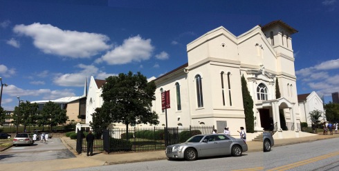
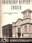
The Georgia Dome (c.1992) behind Mt. Vernon Baptist peeking out from behind Friendship Baptist Church on Mitchell St., Atlanta
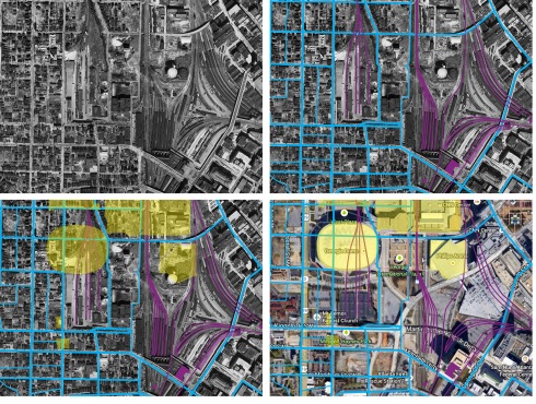
Mt. Vernon Baptist Church began in 1959 and still retains it’s mid-century sanctuary. Mt. Vernon was built at the intersection of Hunter (now MLK) and Haynes, a fragment of which still exists for now, on the 1949 aerials the lots appear to be empty (yellow block just below the Georgia Dome), and across Haynes St from the long back wall of an industrial rail yard.
On the edge of what we now call Vine City, this area was home to the African-American elite of Atlanta in the mid-20th century. It had long been home to African-American institutions like Morehouse and Spelman. In the 20th-century Vine City was home to Atlanta’s business and later Civil Rights leaders—Martin Luther King, Jr.’s family lived out there as did Alonzo Herndon, a leader in the business community. Friendship’s role in this community was strong, they even claim to have housed the earliest classes of Morehouse and Spelman and certainly contributed to the raising of Atlanta’s first black mayor, Maynard Jackson, whose father, Maynard, Sr., was pastor from 1945-1953.
So, to really picture this neighborhood before the Georgia Dome, I’m turning to some old maps (1949 aerials):
In 1949, the neighborhood west of the future Georgia Dome was primarily residential, packed tight on unpaved streets and alleys. The Dome itself sits halfway on the industrial yard that was east of Mt. Vernon, the rest of the World Congress Center and Philips Arena are located on what were once residential streets north of the industrial yard and between rail lines that once led to Terminal and Union stations. Commercial buildings lined Mitchell and the former Hunter St. which were entry points to the west side of Atlanta, only a few blocks from Terminal Station (bottom left purple block). Terminal Station was demolished in 1971-72, apparently beyond the reach of the preservationists who rallied to save the Fox a few years later and I wonder sometimes if my 18-year-old dad first entered Atlanta from under that arched colonnade, one of its last passengers.
Friendship Baptist then, constructed in 1871, saw the whole westside grow up around it. And though its location today feels adrift in a sea of redirected (mis-directed?) streets, parking lots and fences but its position in the community was anchored by this once-prominent location on Mitchell. No doubt the Mt. Vernon congregation felt they’d come across prime property too when they built in the 1950s just behind Friendship.
Today’s aerial view is full of holes, a widened Northside Dr. adds to the expanse of pavement here, blocks full of homes and shops that were not overlaid with oversized arenas have been redrawn with inward-looking housing projects or parking lots. There are many empty lots and fast food chains. There are a lot of fences. Imagine a downtown Atlanta street grid, walkable, human-scale, that marched westward from train tracks instead of a west side that’s been wiped clean of anything historic—except for Friendship Baptist Church. And now that, the root of so much Atlanta history, is about to be wiped clean too.

